This function opens a dialog window for the user to select which identifying variable in the shapefile should be used to label the polygons for aggregation. The dialog window looks like this.
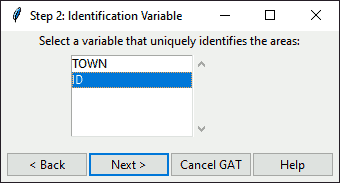
Figure: Dialog to select your identifier variable
Click on your desired identifier in the drop-down list. Then click on one of the following buttons.
Click
Nextto continue to the next step.Click
Cancelto end GAT.Click
Backto return to the previous step.Click
Helpto get further guidance and open this manual.
identifyGATid(shp, step = 2, backopt = TRUE)Arguments
- shp
Spatial layer.
- step
Integer step in the GAT program, for help reference.
- backopt
Boolean denoting whether to include the back button.
Details
This variable will be duplicated and modified by the aggregation to provide new identifiers for newly created polygons. Any unmerged polygons will retain their original identifiers.
Examples
if (interactive()) {
# identify the character variable to use as the ID
identifyGATid(shp = hftown)
}
#> [1] "cancel"